3D Population Density Maps of India
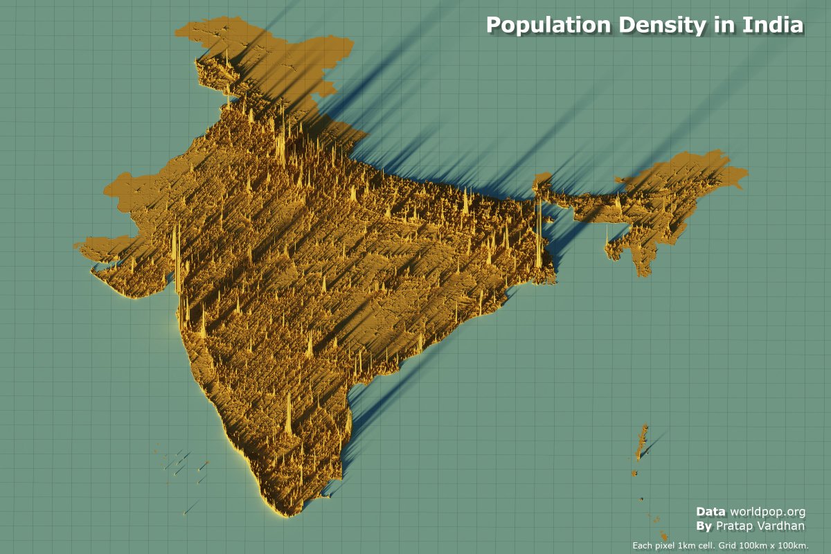
Population density maps provide fascinating insights into how people are distributed across a country. Using data from the WorldPopProject, we took a closer look at India 🇮🇳.

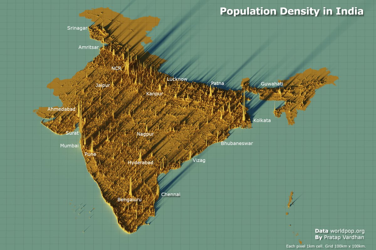
Annotated map
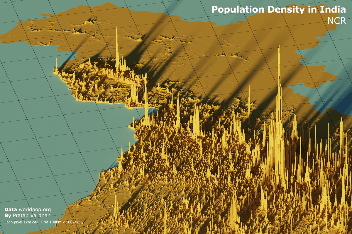
The map reveals the “usual suspects” when it comes to high-density areas. Uttar Pradesh and Bihar dominate as the most densely populated regions, while Delhi and its surrounding areas—extending into Haryana and Uttar Pradesh also stand out.

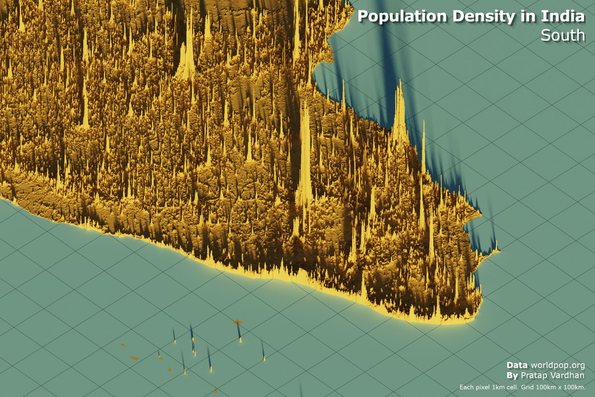
South India
South India showcases intriguing patterns. Kerala’s population density is remarkably uniform along its coastline, a reflection of its distinct geography perhaps. In contrast, Tamil Nadu and Karnataka show a more dispersed population spread.

Most densely populated regions
Uttar Pradesh, Bihar.

India’s capital Delhi and surrounding regions from Haryana, Uttar Pradesh and Rajasthan.

Population density maps are more than just visuals – they’re a window into the demographic and cultural dynamics that will shape the nation.
h/t: Alasdair Rae’s map work.